Access and movement
Private vehicles and access
A new roundabout junction on the A52 and Ambleside will form the principal access to the development, with most of the vehicle traffic expected to access and leave the site from this new junction. The detailed design of this access will be secured through the outline planning application. A secondary point of access to Tollerton Lane will be provided as a ‘left in, left out’ arrangement.
Whilst the new A52 roundabout is being built, it is proposed that the site will initially be accessed via Tollerton Lane from the A52, in the form of an upgraded signalised junction. This will be downgraded to the left in left out access, as mentioned above, once the main access point (roundabout junction with the A52 and Ambleside) has been delivered.
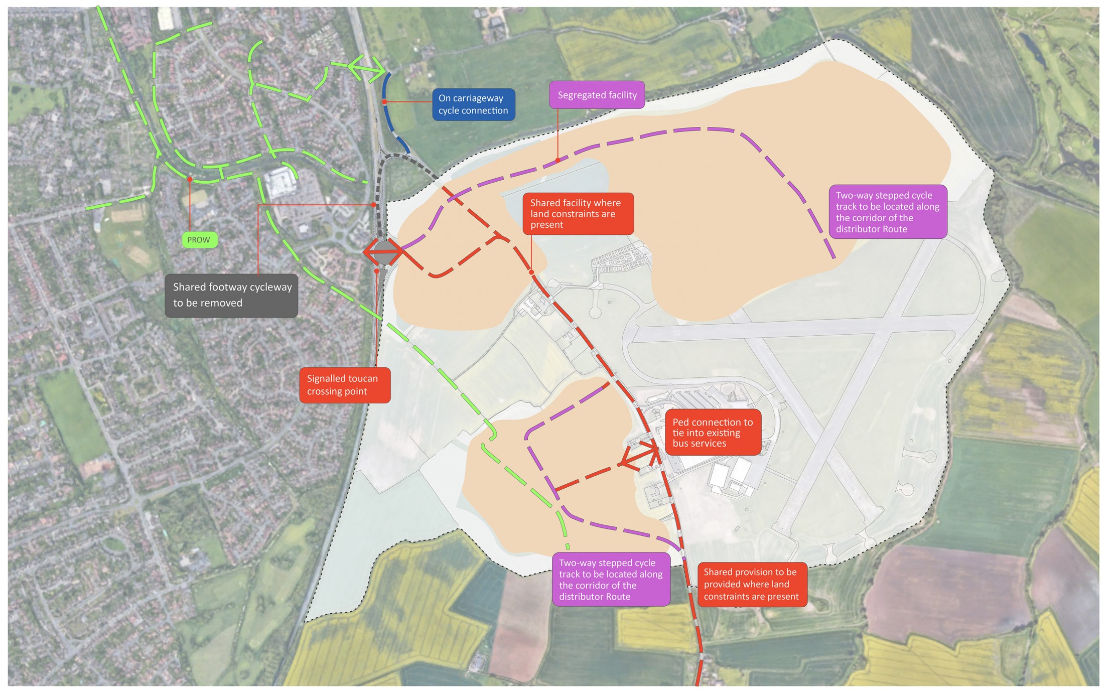
The main roundabout access will incorporate controlled pedestrian and cycle crossing facilities into its design, providing a connection along key pedestrian routes from the site to facilities at Ambleside, including the health centre, pubs and the Morrisons supermarket.
The vehicle access strategy has been designed to deter rat running south of the site along Tollerton Lane by making the quickest and most direct route out of the site to the north west, via the new A52 roundabout.
Other measures being considered to deter rat running to the south of the site involve a downgrading of the traditional, engineered highway through villages, creating gateway features, slowing traffic, improving pedestrian and cycle infrastructure, changes to surfacing, and generally creating a more ‘village’ feel to the area.
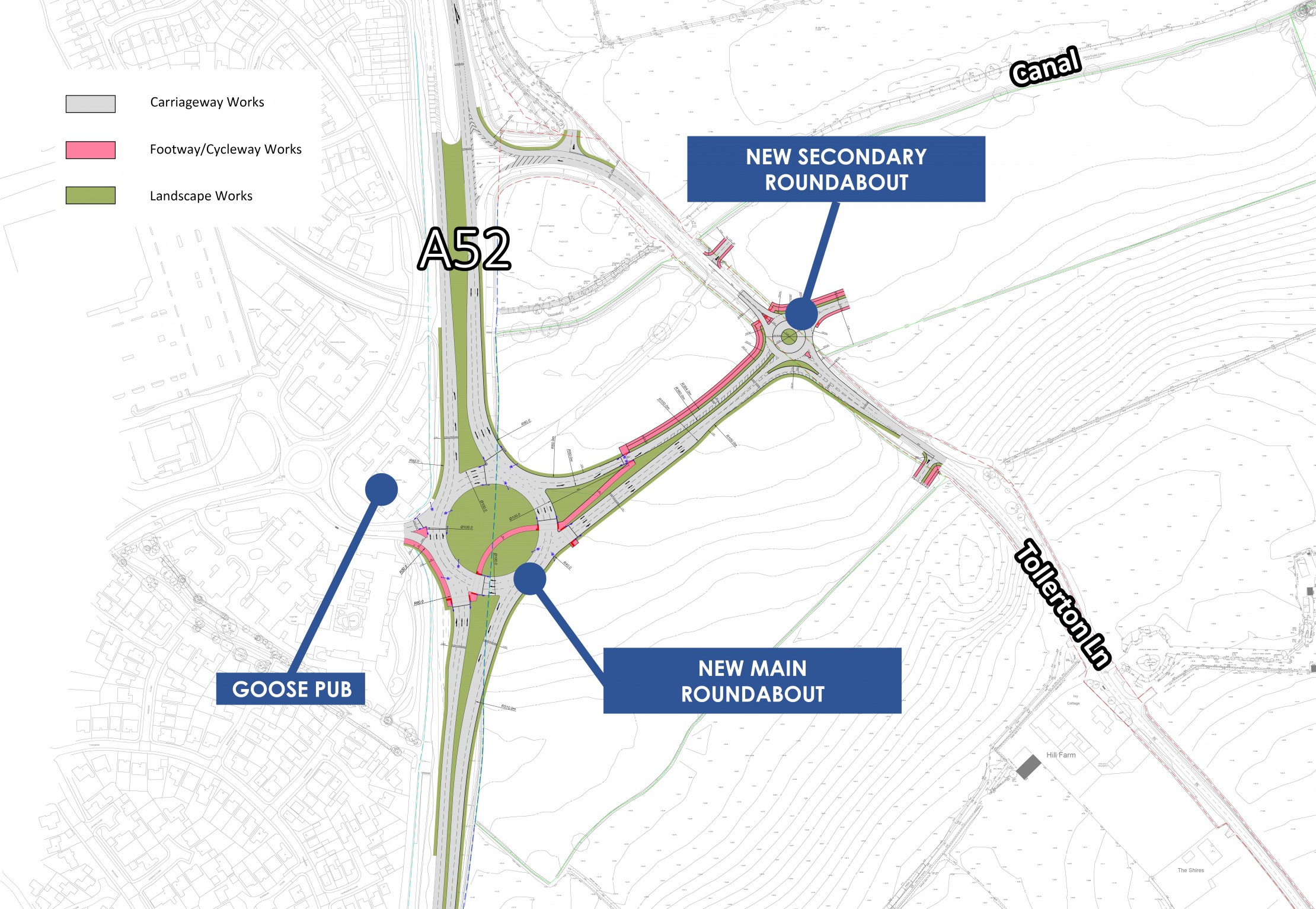
Proposed A52 roundabout access to Tollerton Lane and Gamston district centre
Public transport
A new bus service and improvements to the existing bus services will be secured through the outline planning application and discussions with bus operators are ongoing to agree the most appropriate combination of new and diverted bus services.
Pedestrian / cycle links
The Masterplan provides for a network of pedestrian and cycle links throughout the new development to maximise non car use around the site. This network will link new homes with areas of open space, local centre, employment, and schooling. The outline planning application will provide details of the first phase of this network.
In addition to the network of internal pedestrian / cycle routes, external pedestrian and cycle links will be provided to the existing nearby facilities, such as the Morrisons supermarket. This will include a controlled pedestrian and cycle crossing over the A52, as well as a new trail alongside the Grantham Canal. These links will connect with existing public rights of way where required.