A Sustainable, Future-Fit Development
Sustainability sits at the heart of the proposals, shaping everything from the design of new homes to the creation of green spaces and sustainable travel routes, ensuring a resilient neighbourhood for generations to come.
During the first phase of consultation, some respondents told us they wanted to better understand how the proposed development would be sustainable. In response, we have further developed our approach and introduced a range of measures to embed sustainability throughout the scheme. This includes the implementation of a comprehensive sustainable travel strategy, an extensive network of green infrastructure, and the delivery of energy-efficient, low-carbon homes.
Active Travel Strategy
As part of our commitment to creating a sustainable, future-ready community, Persimmon are developing an Active Travel Strategy that promotes greener, healthier ways to move around. It also delivers a comprehensive network of over 7.5 kilometres of walking and cycling routes, connecting key destinations and encouraging active lifestyles.
The strategy supports and encourages active travel through the provision of safe, accessible, and well-connected infrastructure. Embedded within the site’s masterplan, it informs the layout of trails, streets, and neighbourhood zones to make walking and cycling the natural and convenient choice for residents and visitors. During the initial consultation, feedback revealed that a proportionate number were unsure or disagreed, that the masterplan’s design was effective in encouraging active travel. We have since reviewed our proposals and incorporated feedback to ensure the design reflects the demands of the strategy to encourage sustainable travel.
The network of routes has been thoughtfully designed to ensure the seamless interaction between different paths to create a coherent and connected movement system across the site. To make the site as accessible and inclusive as possible, the masterplan includes a variety of trails and cycle paths to cater for different uses – from children to commuters. Central to the Active Travel Strategy is safety. The site will include cycle friendly junction to ensure the smooth flow of traffic, and pedestrian access will be prioritised in the road design.
New travel networks will connect residents with key services both within the development and in the surrounding area. By creating a high-quality, accessible environment that encourages sustainable travel patterns, our evolved proposals make it easier for everyday needs to be met within a short walk or cycle from home.
Sustainable Homes & Landscape Protection
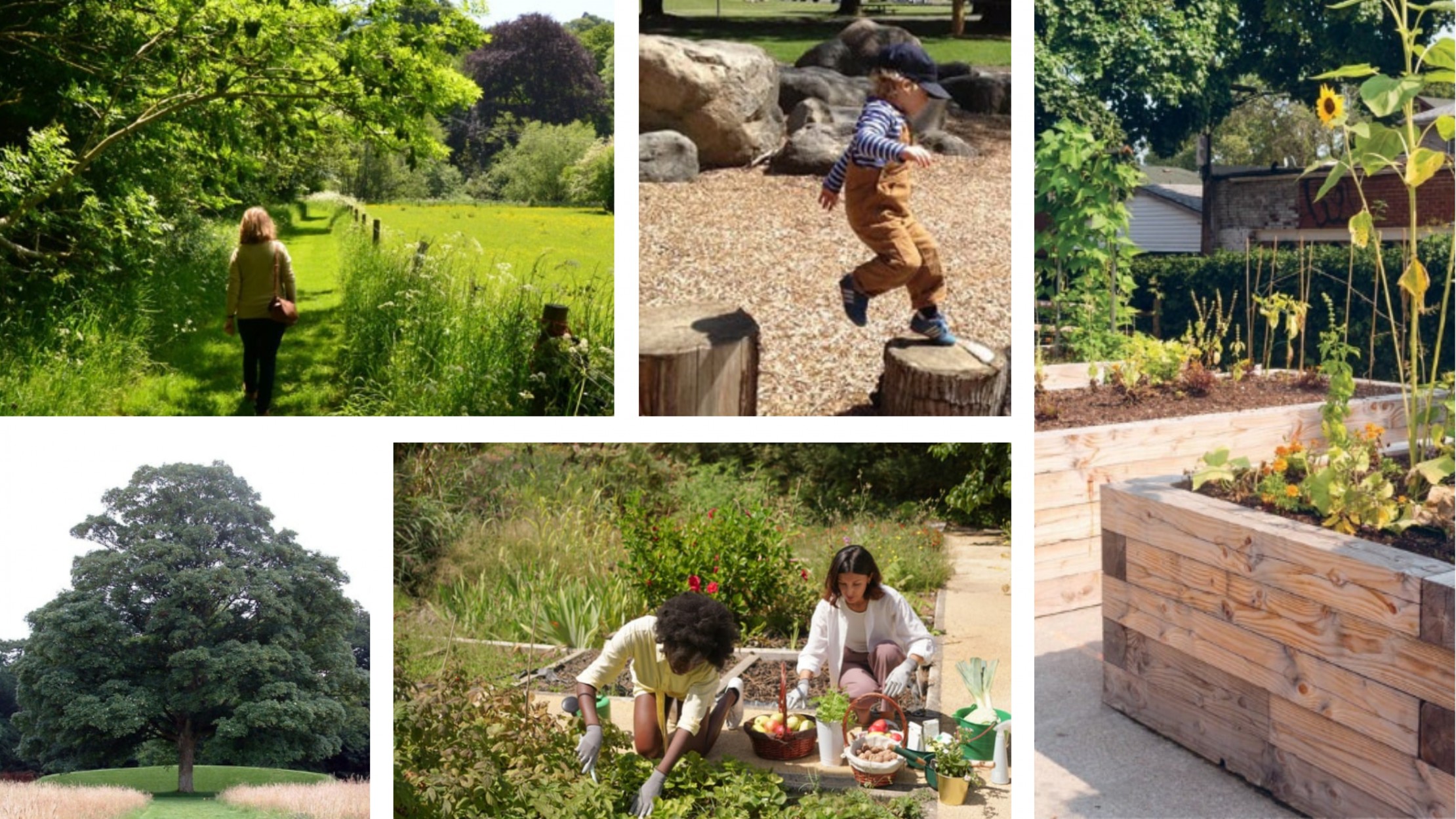
Persimmon is committed to building carbon-efficient homes that help lower emissions and create greener, more sustainable places to live. All homes will be designed to adhere with the latest government standards and the outcomes of Lancaster City Council’s ‘Climate Change Emergency – Local Plan Review’. This includes the incorporation of low-carbon technologies such as air source heat pumps and photovoltaic panels, helping to lower energy use and reduce carbon emissions across the development.
Biodiversity & Ecological Enhancement
Protecting and enhancing the natural environment is central to the design of our proposals. Important ecological features on site such as Long Bank Wood, Ridge Wood, and the Newton Beck Wetland Corridor will be carefully retained and protected to form the foundation of a new green infrastructure network across the site.
Much of the site is proposed as green space. The relocated Golf Course amounts to approximately 30% of the overall site area. Of the remaining site area, over 50% is proposed as open space to include a new County Park, areas for play and relaxation, and areas for wildlife enhancement and recovery. This network of open space will be formed through a mixture of woodland planting, orchard planting, hedgerows, wildflower meadows and wildlife ponds, all of which will create, strengthen and connect habitats to increase the ecological diversity across the site.
Play areas for children of all ages will be situated across the site, creating an inclusive, family friendly environment. In 15 different places, play provision is located to ensure good coverage and accessibility. Together, these areas will provide attractive outdoor spaces for the community and play a crucial role in supporting local ecosystems.
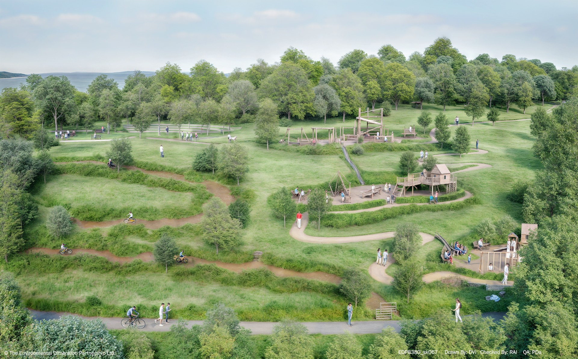
Country Park CGI
Managing Flood Risk & Surface Water
We have assessed the flood risk from Newton Beck using flood estimation methods and computer modelling. We will undertake further modelling to aid the design of crossings and the reinstatement of a natural channel through a currently culverted section. Our aspiration is to reduce flood risk overall to both the site and the surrounding area. Most of the water on the site runs into the Newton Beck which ultimately leads to the Lune River. Surface water from the development is proposed to flow into Newton Beck to mimic existing drainage catchments. Should the development create more surface water than the site does currently, excess water will be stored in Sustainable Urban Drainage (SuD) systems and discharged gradually at a rate agreed with the Council.